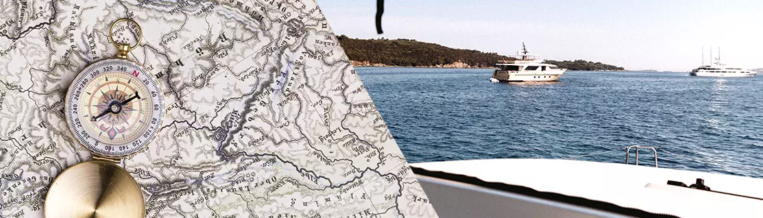
When it comes to navigation, a course is never just a line on the sea. It is the result of tools, skills, and experience. Among these, nautical charting – both digital and paper – remains one of the key elements in ensuring safety, accuracy, and peace of mind during a sailing or motorboat cruise.
GPS: technology and precision at your fingertips
Today, every charter vessel is equipped with one or more GPS plotters, tools that have revolutionized the way we navigate. Thanks to electronic charting, GPS allows you to:
- know the vessel’s position in real time
- display routes, waypoints, and harbors
- monitor depths, shoals, obstacles, and restricted areas
- integrate weather data, AIS, and radar (when available)
The great advantage of GPS is its speed of interpretation and accuracy: even in poor visibility or when sailing at night, the skipper always has a clear picture of the situation. For this reason, it has become the primary tool in modern navigation.
Paper nautical charts: a timeless tradition
Despite technological advances, paper nautical charts remain an essential reference. They are always present on board our vessels, and not just for regulatory or traditional reasons.
Paper charts offer:
- a broader overall view of the navigation area
- a reliable backup in case of electrical or electronic failure
- an excellent learning tool for understanding routes, bearings, and planning
Knowing how to read a nautical chart means understanding symbols, depths, buoys, lighthouses, and alignments—skills that make a real difference, especially in coastal navigation or in less familiar areas.
GPS and paper charts: not an alternative, but a complement
The most common mistake is to think that GPS and paper charts are alternatives. In reality, they perform best when used together. GPS is perfect for immediate, operational navigation, while paper charts are ideal for:
- planning the route before departure
- assessing distances and travel times
- having a “big picture” view of the cruise
A prudent skipper always checks that what is seen on the screen matches what is shown on the chart.
Equipment on board our boats
The vessels in our charter fleet are equipped with up-to-date GPS plotters and nautical charts suitable for the cruising area, ensuring the highest level of safety and comfort. During the departure briefing, our staff is always available to explain how the onboard instruments work and to provide useful advice on route planning.
A final recommendation: know your cruising area well
Finally, we always recommend carefully studying the cruising area in advance before starting your charter. Knowing the coastline, depths, prevailing winds, safe harbors, and potential hazards allows you to plan your itinerary more effectively and enjoy the sea with greater peace of mind. Good preparation, combined with the proper use of both GPS and paper charts, is the key to safe, relaxed, and truly enjoyable navigation.
Book your next vacation and contact us: info@nsscharter.com
Contact us by WhatsApp: